
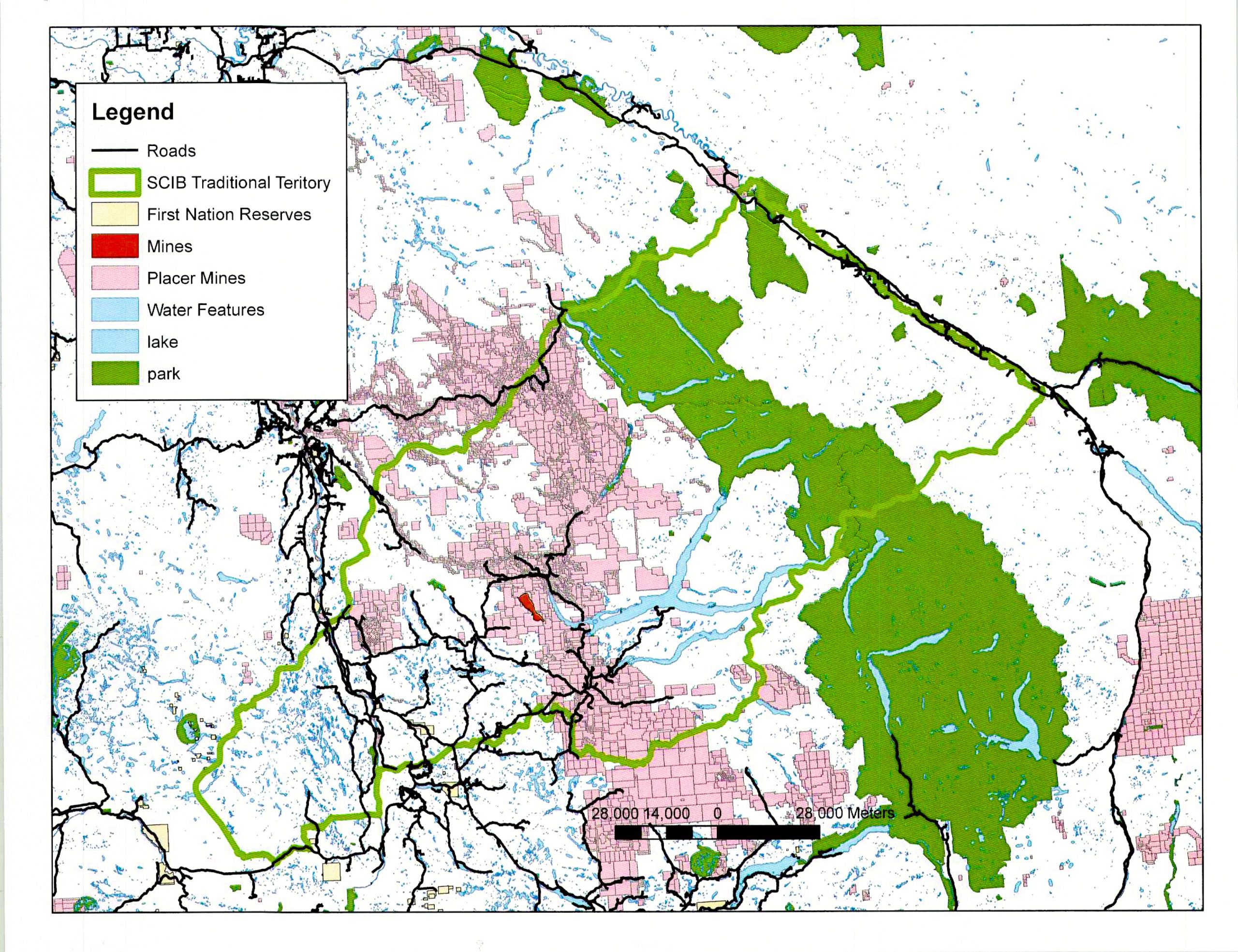
Xatśūll First Nation has an extensive traditional territory with ongoing development. It is our responsibility to be the liaison between the stakeholders and the band. We try to address as many concerns in regards to stewardship in our referral process. We also have agreements with larger companies where we can discuss higher-level concerns.
Our Referral Process
A referral is a written report in response to government or industry that wants to perform work on traditional Xatśūll territory. Referral responses highlight the potential impacts of these activities on Xatśūll Title and Rights, environmental resource management and environmental sustainability. Combining legislative and scholarly reviews with on-site visits, the Referrals Coordinator develops a response that highlights concerns and suggestions to proponents. These responses are then sent to the government and individual decision-makers. This can impact the planning, operation, and restoration aspects of each activity. Referrals are typically in response to Forestry and Mining operations, agriculture and range, water licenses, and residential development.
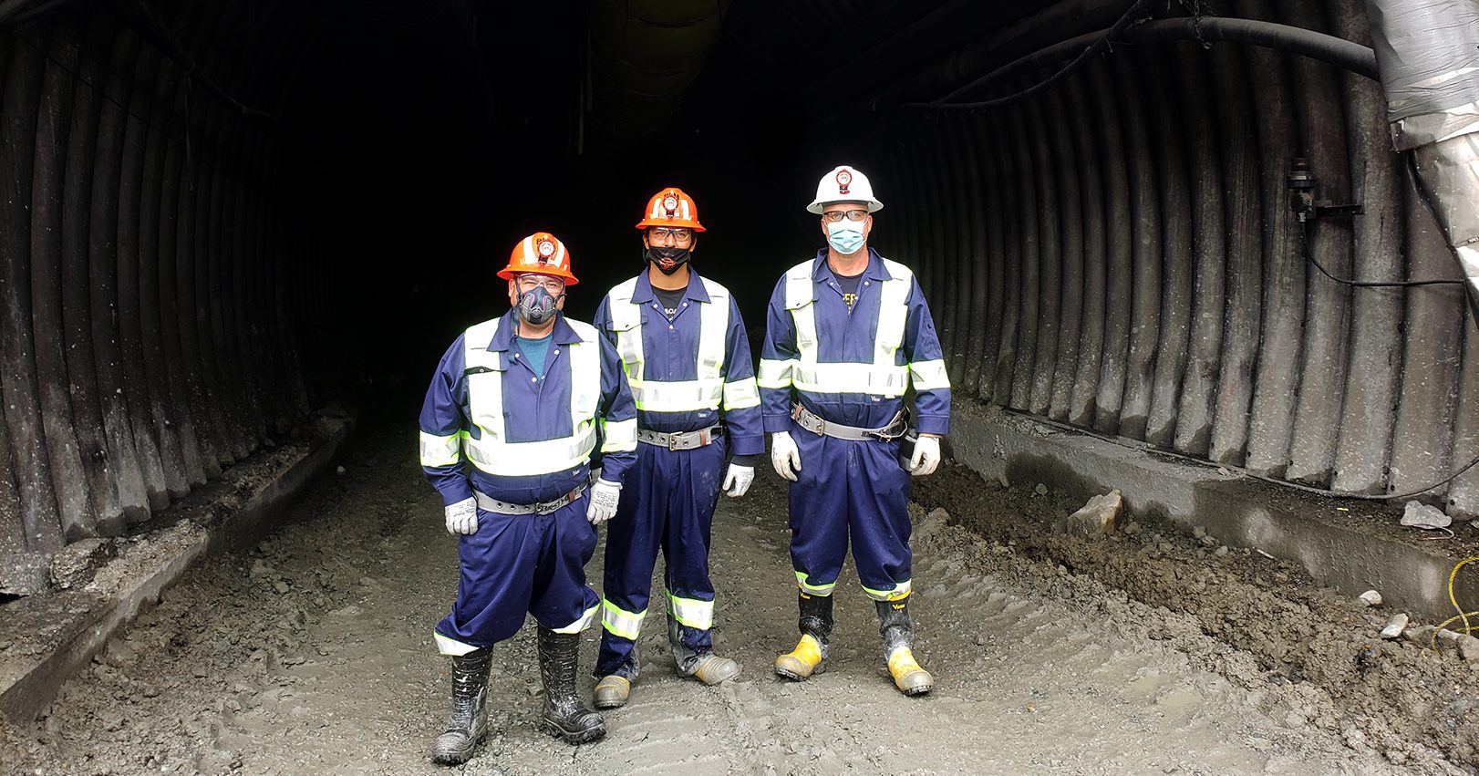
Mines
There are multiple large mines in traditional Xatśūll territory. We have relationships and develop Participation Agreements with these mines. This enables us to have monthly or bimonthly meetings with the mines to discuss upcoming permits, environmental monitoring, restoration work and other on-goings at the mines. The Natural Resource Department and our economic Development Corporation both attend these meetings. Recently, we’ve been working closely with Mount Polley, Gibraltar, Barkerville Gold Mines and Spanish Mountain Gold Ltd.
Placer Mines
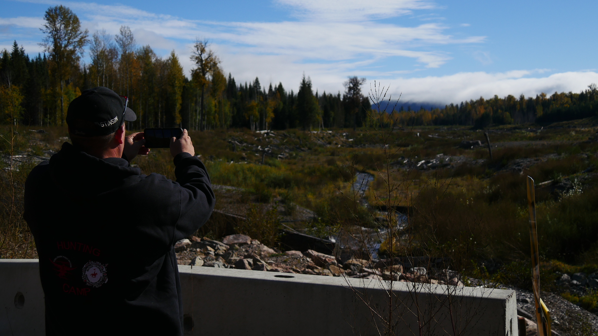
Xatśūll territory is rich in minerals and has a good terrain and water available makes it abundant in placer mines. As streams and rivers change course, they expose different minerals. Placer mines dig in these areas (alluvial deposits) in the hopes of finding valuable minerals. Proponents can process larger amounts of sediment through big machines using water to separate the larger rocks from smaller rocks and soil. Smaller rocks and fine material go to the sluice box this is where the gold and other valuable materials are found. To get at the valuable material miners can pan or use a finer sluice box. Water is used throughout this process; when the process finished, the water is placed in a settling pond and re-used. Currently, proponents can go online and stake a claim. The areas around the Quesnel River, Cariboo River and Swift River are packed with placer claims. This is concerning for the NR department because we are told those are areas that hold traditional value.
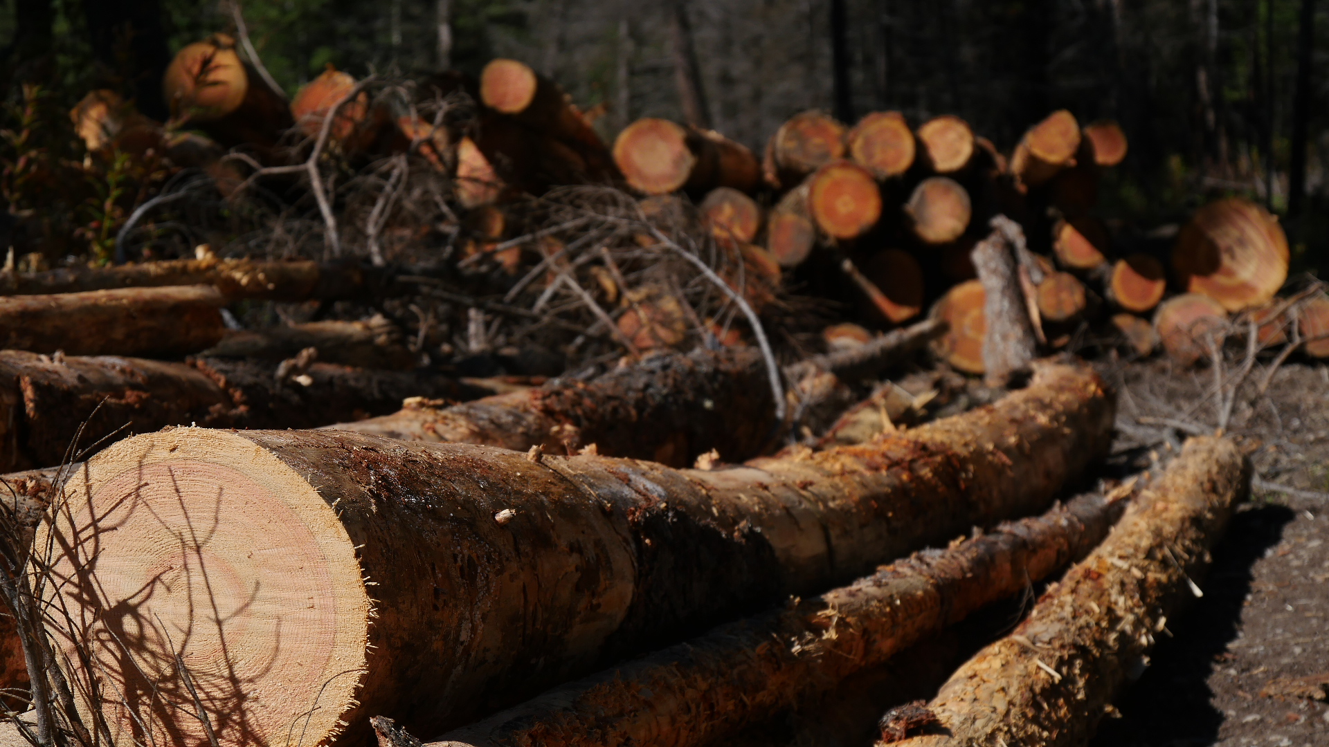
Forestry
One of the main industries within Xatśūll territory is forestry. It extends all throughout with licenses harvesting crown land, woodlots and community forests. The large number of clear cuts are of concern to the Natural Resources Department. Therefore we try to focus on landscape level objectives. This means that we express serious concerns over riparian areas, water bodies, connectivity, harvesting plants, location of wildlife tree patches. This is fundamental as it will determine the survival of large animals such as moose and deer. We have agreements with Tolko, West Fraser Williams Lake and West Fraser Quesnel. These agreements allow us to have a higher level of consultation and provides us with economic and employment opportunities.
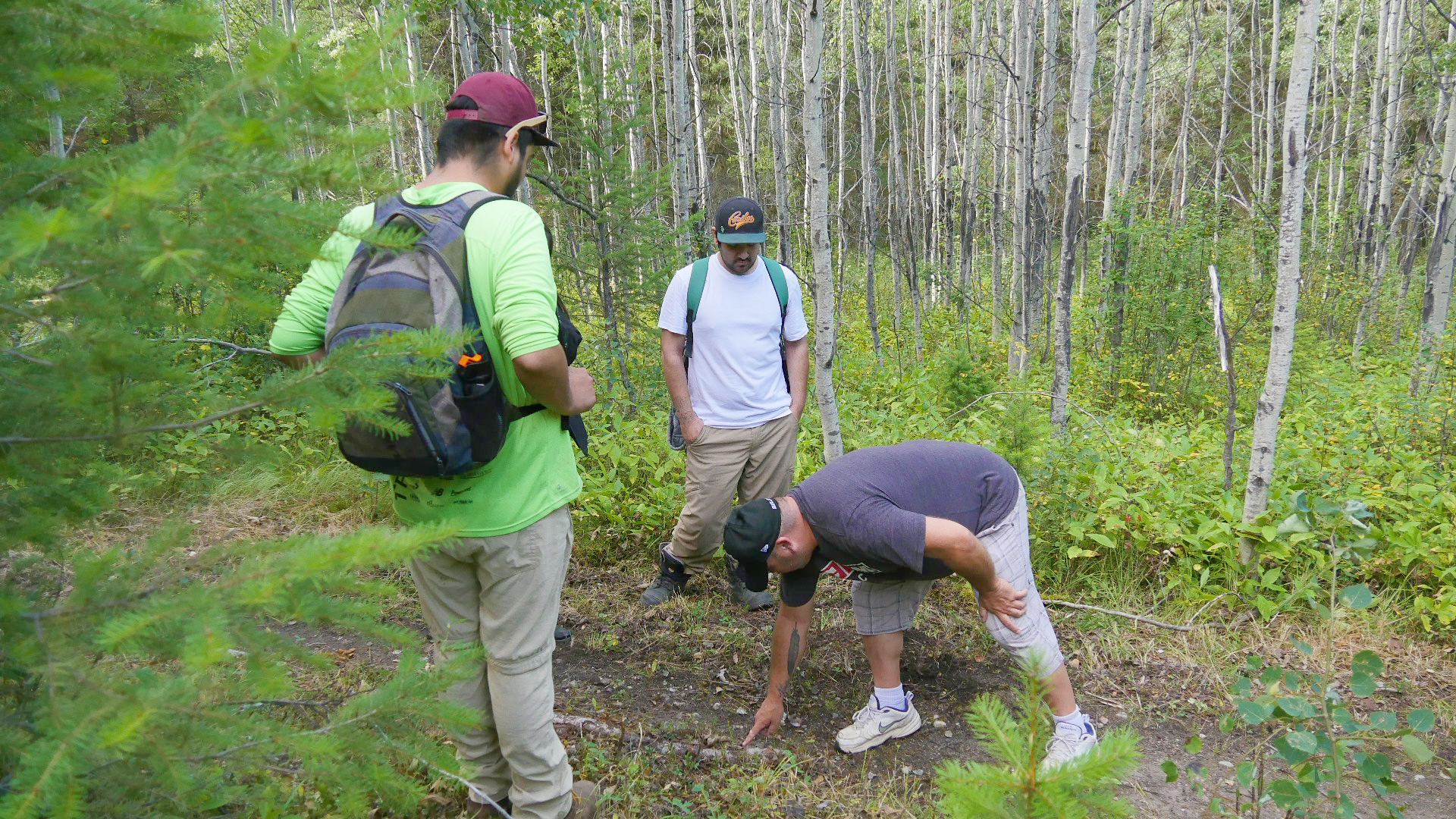
Environmental Monitoring and Archeology
The Natural Resource Department often hires Environmental Monitors from the community to go out on various larger projects to monitor how environmentally safe the project is. Some example projects would be water sampling with Gibraltar, stream restoration work, Bridge replacements, BC hydro projects, etc. Archaeology is also a major corner for the NR Department. This is because it is such a fundamental part of Xatśūll culture and history. For this reason, when the land is been disturbed we ask for archaeological assessments or preliminary a field assessment. This helps us determine if there are any features in the area of interest. This also allows for some community members to be employed. Under the BC Heritage Conservation Act archaeological sites cannot be altered without a provincial permit—one of the ways archaeological sites are protected. Xatśūll has also recently started an Environmental Services business in partnership with Terra Archeology.
Joint Resource Committee
The NStQ Joint Resources Committee (JRC) was developed as a forum for the four NSTQ communities to work collaboratively on natural resource issues of common interest.
Currently, the JRC is working on a Collaborative Natural Resource Stewardship Agreement that formalizes this relationship by providing structure and guidance. Each NStQ community is represented at the monthly JRC meetings by its natural resource staff and treaty managers. Representatives from community Economic Development Departments also attend JRC meetings as a way to share information and collaborate on the economic development of natural resources. Typical agenda items at JRC meetings include:
– development of joint responses to proposed activities,
– updates and discussion on Government to Government Agreement negotiations,
– economic opportunities affecting natural resources on shared territory, and
– discussion on how best to further develop NStQ collaborative capacity in a way that respects the goals of individual communities.

Emily Sonntag
Land & Natural Resource Director
Morgan Mueller
Natural Resource Coordinator

Yoana Dinkova
Environmental & Regulatory Coordinator

Darrin Sargent
Referrals Coordinator
Jessie Hunlin
NR Assistant
Glen Dixon
NR Technician